Last Updated on 9th June 2026
Getting home loan is very BASIC now
Get a loan in under 5 mins

Last Updated on 9th June 2026
Owning land in Goa is not just a financial decision. It is about legacy, security, and often, family history. Because of that, understanding how Goa land records work is critical, whether you are buying a flat in an urban area or inheriting agricultural land in a village.
Goa has one of the more advanced land-records ecosystems in India, with a mix of historic cadastral surveys and modern digital systems like the Dharani Land Records Management System, DSLR portal, GoaOnline services, and BhuNaksha maps. Together, they cover ownership data, mutation, survey plans, and property maps.
This guide walks through everything you need to know, in plain language, with sourced facts and practical steps.
In Goa, land records are primarily maintained by the Directorate of Settlement & Land Records (DSLR), under the Revenue Department. The DSLR is responsible for:
On the digital side, three main systems are relevant:
When people talk about Goa’s online land records, they usually mean a combination of these documents:
|
Record type |
What it contains |
Why it matters for you |
|
Form I & XIV (RoR) |
Owner/tenant name, survey & subdivision no., area, land use, tenancy details |
Primary proof of who is recorded as the holder of the land and how it is classified |
|
Form D |
Tenancy and cultivation details |
Important for agricultural rights and tenancy-related disputes |
|
Survey plan / cadastral map |
Shape, size and boundaries of plots, survey numbers, adjoining plots |
Used for boundary disputes, development, fencing and layout approvals |
|
Mutation record/case status |
How and when ownership changed, mutation case numbers, and status |
Shows whether the latest sale, inheritance or partition has been legally reflected |
|
Property tax / municipal record |
Property ID, assessment, address, tax due/paid |
Helps verify urban property details and avoid legacy tax liabilities |
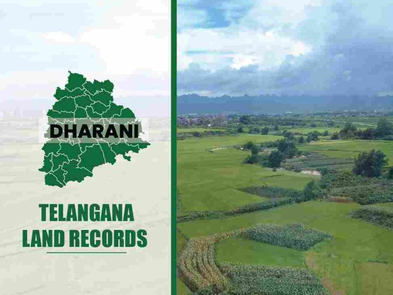
If you search for “Dharani”, you might see references from other states, but Goa has its own DHARANI: Land Records Management System deployed by the Revenue Department and NIC Goa.
Goa’s Dharani is essentially the digital backbone for:
The public usually interacts indirectly with Dharani via:
According to NIC’s article on Goa DHARANI: Digitally Signed Land Records of Goa, the Dharani system was built to replace manual registers with secure, digitally signed records.
Key features include:
For a buyer or existing owner, the practical takeaway is simple: whenever possible, request digitally signed copies through GoaOnline rather than relying only on printouts or screenshots of goa land records pages.
Most people begin with a simple check of basic ownership and survey details. That is usually done through the DSLR GoA web portal and GoaOnline-related services that expose land and survey records in Goa to citizens.
The DSLR Form I & XIV page lets you view an information copy for a given survey number and subdivision.
General steps:
You will see an on-screen information copy of Form I & XIV. It is clearly marked as “for information purposes only”. For an official copy, Goa directs users tothe GoaOnline services.
The GoaOnline “Property / Land Information” section provides a consolidated entry point for multiple land-related services and states that:
Many users casually refer to this as checking Goa land records or “land and records Goa” online. It is important to remember that:
If you need to show proof to a bank or court, always fetch an official, digitally signed copy.
How do you download Form I & XIV Goa land records online?
Form I & XIV is the heart of the Goa land records for most property transactions. It is often treated as the “Record of Rights” and is required by banks, lawyers and buyers.
To get an official, digitally signed copy, Goa asks you to apply via GoaOnline under the “Form I and XIV” service.
According to the GoaOnline service description:
1. Register and log in
2. Open the Form I & XIV service
3. Select location details
4. Search by survey details
5. Request a digitally signed copy
6. Make a payment and download
Most users who search for Form I & XIV Goa land records online are looking precisely for this flow.
Here is a simplified view of the data fields typically present in Form I & XIV (content may vary by property).
|
Field /Section |
What it indicates |
What you should check as a buyer/owner |
|
Taluka and Village |
Administrative location of the land |
Matches the address and the sale deed |
|
Survey number & subdivision |
Unique identifier of the land parcel |
Same as in the sale deed, mutation order and map |
|
Name(s) of occupant/owner |
Person(s) recorded as holders/tenants |
Matches seller/family documents; check for multiple names |
|
Area |
Area of the plot in sq. m / hectares |
Consistent with the layout plan and the sale deed |
|
Land use/classification |
Agricultural, non-agricultural, garden, etc. |
Whether the current or proposed use (residential/commercial) is legal |
|
Tenancy/cultivation entries |
Details of tenants or cultivators, if any |
A hidden tenancy may affect your right to enjoy the land |
|
Remarks/encumbrance notes |
Notes on disputes, court orders, reservations, government holdings, etc. |
Red flags you need to discuss with a lawyer |
Whenever you use the Goa land records survey plan or RoR extracts to support a loan or transaction, cross-verify these details against:
If there is a mismatch, take it seriously before proceeding with payment.
Ownership entries tell you who owns the land. Survey records and maps tell you where that land lies and how much of it exists on the ground.
In Goa, survey and mapping functions are powered by:
The DSLR site offers a “Maps” / Bhunaksha section, where you can view village-wise cadastral maps.
Typical steps:
The site clearly notes that:
The map is provided for information purposes only. An official copy can be obtained from GoaOnline after making the necessary payment.
That means, for fencing, boundary disputes, or court matters, you should apply for a digitally signed survey plan.
There is also a dedicated BhuNaksha Goa portal that works like a GIS viewer for cadastral maps:
This is particularly useful when you want a satellite-like graphical view alongside your land survey records Goa.
If you need an authenticated plan, use the GoaOnline service Issuance of Digitally Signed Survey Plans:
When someone searches for land survey records in Goa or the Goa land records survey plan, this is often what they are ultimately trying to get.
A mutation is the official recording of a change in ownership or other rights in the revenue record. Without mutation, your sale deed or inheritance may not be reflected in Goa land records, which creates problems later for loans, resale or disputes.
In Goa, mutation is handled by the Revenue authorities and managed digitally through Dharani and DSLR systems.
You should initiate mutation in the following cases:
The Dharani system records that:
Online Mutation applications are received in Dharani from citizens through the GoaOnline portal.
Typical flow in practice:
The DSLR portal provides a “Mutation Status” page.
General steps:
Some explanatory articles also mention optional filters like applicant name and request date, but what you actually see may depend on current portal features.
If you are in the middle of a purchase, it is wise to:
Most official portals in Goa are primarily survey-number driven, which means you often need at least:
to pull the Goa land records. This is true for:
People often ask for Goa land records by name, expecting a simple name-based search bar. The reality is more nuanced:
In practice, if you only know the name but not the survey number, you may need:
So while Goa land records by name is a popular search phrase, you should be prepared to work backwards from address and local documents to the survey number first.
Depending on the portal and module, you may be able to search using:
The more accurate your base details, the more reliable your search on the Goa online land records will be.
If you are buying property in Goa, do not treat land records as just a formality. They protect you from bad titles and future litigation. Use the combination of land and survey records goa, maps and mutation data to run a basic due diligence.
Here is a practical checklist that most lawyers and bankers informally follow (this is informational, not legal advice):
1. Confirm the current owner in Form I & XIV
2. Check for multiple names or co-owners
3. Verify land use classification
4. Review tenancy or cultivation entries
5. Cross-check the area and boundaries with the survey plan
5. Verify mutation chain
6. Look at property tax and local body records
7. Match documents with physical reality
Using the Goa land records this way turns them into a practical risk-reduction tool rather than just paperwork for the bank.
Even with Dharani and full digitisation of cadastral maps, issues do arise. Some of the common pain points are:
1. Name spelling mistakes or old names
2. Outdated ownership (mutation not done)
3. Boundary disputes are not reflected in maps
4. Old Portuguese-era references
5. Digitisation gaps or missing records online
None of this replaces professional legal advice, but going prepared with clear printouts from the Goa online land records and Bhunaksha speeds up discussions with officials and lawyers.
Goa is not working in isolation. It is part of national programmes aimed at modernising land governance, such as the Digital India Land Records Modernisation Programme (DILRMP).
Key directions you should be aware of:
1. Full digitisation and encrypted archival
2. GIS-based access
3. Integrated digital registries
4. Better online services for citizens
Bringing it all together, here is a simple action plan for using goa land records and Dharani-backed services wisely:
1. Start with survey details
2. Pull information copies online
3. Get certified documents via GoaOnline
4. Check mutation history and status
5. Cross-check with physical reality
6. Document everything
Even if you later choose to use third-party apps or services that aggregate goa land records, understand that the source of truth remains the official DSLR, Dharani and GoaOnline systems. Using them directly, with awareness of how they work, puts you in a much stronger position as a buyer or landowner.
Goa has quietly built one of the more robust land-record systems in the country: full cadastral digitisation, Dharani-backed digitally signed records, live Bhunaksha maps and a citizen-facing GoaOnline portal that ties it all together. If you learn how to navigate the Goa land records, Form I & XIV Goa land records online, land and survey records Goa, and related services with confidence, you are not just “downloading a document”. You are protecting your money, your home and your peace of mind.
| Punjab Land Record | Odisha Land Record | Assam Land Record |
| Delhi Land Record | Andhra Pradesh Land Record | Bihar Land Record |
| West Bengal Land Record | Haryana Land Record | Uttarakhand Land Record |
The Dharani Portal in Goa is the state’s digital Land Records Management System used by the Revenue Department and DSLR to maintain and issue digitally signed goa land records. It supports online mutation workflows, storage of settlement and land records, and back-end generation of certified copies of Form I & XIV, Form D, and survey plans that citizens access via the GoaOnline and DSLR portals.
To check your Goa online land records, you can:
Visit the DSLR Goa portal and open the Form I & XIV section.
Select your Taluka and Village.
Enter the Survey Number and Sub-division Number.
Submit the form to view an information copy of your record of rights.
For an official, digitally signed copy of your goa land records, you need to log in to the GoaOnline portal, choose the Form I & XIV service, and apply by selecting your location and survey details, then pay the applicable fee.
To apply for land mutation in Goa, you usually follow this flow:
Prepare documents such as sale deed, gift deed, a partition deed, or inheritance papers.
File a mutation application through the local Revenue office or, where enabled, via GoaOnline, which passes applications into the Dharani system.
Attach supporting documents and pay any prescribed fee.
Revenue officials verify, issue notices, and decide the case.
Once approved, the mutation is updated in land and records goa, and the new owner details appear in Form I & XIV and related land and survey records goa.
Always track the mutation status online (using mutation number and taluka) on the DSLR portal until it shows as approved.
Citizens generally access property maps that are managed in Dharani through the DSLR/BhuNaksha interfaces rather than directly logging into Dharani. To view goa land records survey plan and maps:
Open the DSLR “Maps”/BhuNaksha page.
Choose Rural or Urban, then select District/Taluka/Village.
Enter your Survey Number and Sub-division (if required).
View the cadastral map showing your plot and adjoining parcels.
These on-screen maps are for information only. For legal use, you should apply for a digitally signed survey plan through GoaOnline.
Yes. You can download official land survey documents online in Goa:
Log in to the GoaOnline portal.
Choose the “Issuance of Digitally Signed Survey Plans” service.
Enter district, taluka, village, survey or P.T. sheet/Chalta details.
Submit the application, pay the fee, and then download the digitally signed survey plan once it is processed.
This is the recommended way to obtain authentic land survey records and survey plans, instead of relying only on screenshots or printouts of map views.
Get a loan in under 5 mins